Íomhá:Kilbeheny1.JPG

Size of this preview: 800 × 589 picteilín. Other resolutions: 320 × 236 picteilín | 640 × 471 picteilín | 1,024 × 754 picteilín | 1,280 × 942 picteilín | 2,560 × 1,884 picteilín | 3,410 × 2,510 picteilín.
Taispeáin leagan ardtaifigh den íomhá (3,410 × 2,510 picteilín, méid comhaid: 1.12 MB, cineál MIME: image/jpeg)
| Seo comhad as An Cómhaoin Viciméid. Tá an tuairisc as an leathanach tuairisc Cómhaoin a leanas thíos.
|
Achoimriú
| Tuairisc |
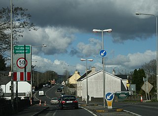
English: The R639 (former N8) through Kilbeheny, County Limerick, Ireland. |
| Dáta | |
| Foinse | Obair féin |
| Údar | Sarah777 |
| Leaganacha eile |
| Camera location | | View this and other nearby images on: OpenStreetMap |
|---|
_heading:45.00&language=ga)
| Object location | | View this and other nearby images on: OpenStreetMap |
|---|
_heading:45.00&language=ga)
Ceadúnú
| I, the copyright holder of this work, release this work into the public domain. This applies worldwide. In some countries this may not be legally possible; if so: I grant anyone the right to use this work for any purpose, without any conditions, unless such conditions are required by law. |
Stair chomhaid
Cliceáil ar dáta/am chun an comhad a radharc mar a bhí sé ag an am sin.
| Dáta/Am | Mionsamhail | Toisí | Úsáideoir | Nóta tráchta | |
|---|---|---|---|---|---|
| faoi láthair | 02:01, 19 Iúil 2008 | | 3,410 × 2,510 (1.12 MB) | Sarah777 | {{Information |Description={{en|1=The N8 through Kilbeheny, County Limerick, Ireland Category:County Limerick}} |Source=self |Author=Sarah777 |Date=10 April 2008 |Permission= |other_versions= }} {{ImageUpload|full}} |
Úsáid comhaid
Tá nasc chuig an gcomhad seo ar na leathanaigh seo a leanas:
Global file usage
The following other wikis use this file:
- Úsáid ar en.wikipedia.org
- Úsáid ar eu.wikipedia.org
- Úsáid ar ru.wikipedia.org
- Úsáid ar www.wikidata.org