Íomhá:Roman Republic Empire map.gif

Roman_Republic_Empire_map.gif(626 × 595 picteilín, méid comhaid: 101 KB, cineál MIME: image/gif, looped, 21 frames, 37 s)

Seo comhad as An Cómhaoin Viciméid. Tá an tuairisc as an leathanach tuairisc Cómhaoin a leanas thíos.
Is stór comhaid meáin Saor é an Cómhaoin Viciméid. Is féidir leat cabhrú.

Bună

Achoimriú

Tuairisc
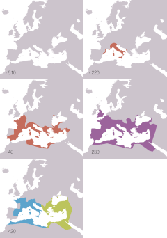
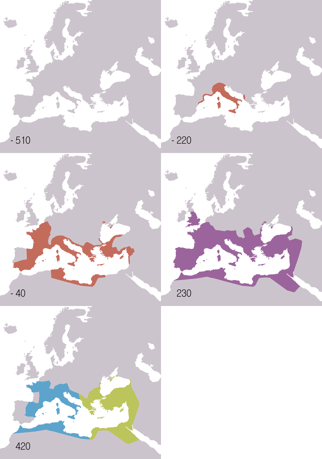
English: Animated map of the Roman Republic and Empire. Displayed in the map:
 
Roman republic 510BC-40BC
 
Roman Empire AD20-AD360
 
Eastern Roman Empire AD405-AD1453
 
Western Roman Empire AD405-AD480
Years shown: 510BC, 320BC, 300BC, 270BC, 220BC, 190BC, 140BC, 70BC, 40BC, AD20, AD70, AD140, AD230, AD300, AD360, AD405, AD420, AD450, AD480, AD530.
Español: Mapa animado de la República y el Imperio Romanos.
 
República Romana 510 a. C.-40 a. C.
 
Imperio Romano 20 d. C.-360 d. C.
 
Imperio Romano de Oriente 405 d. C.-1453 d. C.
Años mostrados en el mapa: 510 a. C., 320 a. C., 300 a. C., 270 a. C., 220 a. C., 190 a. C., 140 a. C., 70 a. C., 40 a. C., 20 d. C., 70 d. C., 140 d. C., 230 d. C., 300 d. C., 360 d. C., 405 d. C., 420 d. C., 450 d. C., 480 d. C., 530 d. C.
Français : Carte animée de la république puis de l'empire Romain.
 
République romaine : de -510 à -40.
 
Empire romain : de 20 à 360.
 
Empire romain d'Orient : de 405 à 1453.
 
Empire romain d'Occident : de 405 à 480.
Années montrées sur la carte : -510, -320, -300, -270, -220, -190, -140, -70, -40, 20, 70, 140, 230, 300, 360, 405, 420, 450, 480, 530.
Русский: Анимированные карты Римской республики и империи. Отображаются на карте:
 
Римская республика 510 до н.э. - 40 до н.э.
 
Римская империя 20 н.э. - 360 н.э.
Годы: 510 г. до н.э., 320 г. до н.э., 300 г. до н.э., 270 г. до н.э., 220 г. до н.э., 190 г. до н.э., 140 г. до н.э., 70 г. до н.э., 40 г. до н.э., 20 г. н.э., 70 г. н.э., 140 г. н.э., 230 г. н.э., 300 г. н.э., 360 г. н.э., 405 г. н.э., 420 г. н.э., 450 г. н.э., 480 г. н.э., 530 г. н.э..
日本語 共和政から帝政のローマ領の変遷。凡例:
 
共和政期 紀元前510年-40年
 
帝政期 20-360年
 
東ローマ帝国 405年-1453年
 
西ローマ帝国 405年-480年(テオドシウス朝と断絶)
年ごとの図: 紀元前510年、紀元前320年、紀元前300年、紀元前270年、紀元前220年、紀元前190年、紀元前140年、紀元前70年、紀元前40年、20年、70年、140年、230年、300年、360年、405年、420年、450年、480年、530年。
Dáta
Foinse
English:
Español:
  • Mapa de base: Image:BlankMap-Europe-v3.png
  • Fuentes:
    • McEvedy, Colin. Penguin Atlas of Ancient History.
    • Haywood, John. Atlas of Past Times.
    • DK Atlas of world history
  • Véase también los siguientes mapas:
  • Français :
  • Fond de carte basé sur Image:BlankMap-Europe-v3.png
  • Source des données :
    • Colin McEvedy, Penguin Atlas of Ancient History
    • John Haywood, Atlas of Past Times
    • DK Atlas of world history
  • Voir aussi ces cartes :
  • 日本語
  • 背景地図はImage:BlankMap-Europe-v3.pngによる。
  • 出典:
    • McEvedy, Colin; John Woodcock (1988) The Penguin atlas of ancient history. Harmondsworth, Middlesex, England: Penguin Books
    • Haywood, John. (2002/2009) The atlas of past times. London: Brown Reference.
    • Black, Jeremy. DK Atlas of world history(ジェレミー・ブラック総監修『世界史アトラス』の原書)
    • 古代ローマの版図拡大図(地図) テキサス大学Perry-Castañeda Library収蔵
  • 外部リンク:
  • Údar Roke (d)
    Leaganacha eile
    English: Version including the Byzantine Empire is at Image:Roman Empire map.gif.
    Español: Image:Roman Empire map.gif: versión que incluye al Imperio Bizantino.
    Français : Image:Roman Empire map.gif : version incluant l'empire byzantin.
    Русский: В том числе версия Византийской империи: Image:Roman Empire map.gif
    日本語 ビザンチン帝国を含む地図 : Image:Roman Empire map.gif
    Camera location47° 00′ 00″ N, 18° 00′ 00″ E  Heading=0° Kartographer map based on OpenStreetMap.View this and other nearby images on: OpenStreetMapinfo

    Ceadúnú

    Is mise sealbhóir cóipchirt an shaothair seo agus foilsím é faoin gceadúnas seo a leanas:
    GNU head Tugtar cead an doiciméad seo a chóipeáil, a dháileadh agus/nó a mhodhnú faoi théarmaí an Ceadúnas Doiciméadúcháin Saor ó GNU, Leagan 1.2 nó aon leagan níos déanaí a d’fhoilsigh an Fondúireacht Bogearraí Saor in Aisce; gan aon Rannóga Inmheánacha, gan aon Téacsanna Clúdaigh Tosaigh, agus gan aon Téacsanna Clúdaigh Cúil. Tá cóip den cheadúnas san áireamh sa chuid dar teideal Ceadúnas Doiciméadúcháin Saor ó GNU.
    w:ga:Creative Commons
    sannadh comhroinn araon
    This file is licensed under the Creative Commons Attribution-Share Alike 3.0 Unported license.
    Is féidir:
    • an saothar seo a roinnt – an saothar seo a chóipeáil, a dháil amach, agus a tharchur
    • an saothar seo a athmheascadh – an saothar seo a oiriúnú
    Ach amháin má leantar na coinníollacha seo a leanas:
    • sannadh – Ní mor creidiúint a thabhairt leis an saothar, faoi mar a shonraigh an údar nó tabharthóir an ceadúnais (ach ná húsáid modh a thugann le fios go thacaíonn sé/sí tú féin nó an úsáid a bhaineann tú as an saothar).
    • comhroinn araon – Má athraíonn tú nó síneann tú amach an saothar seo, ní féidir é a dháileadh ach amhaín faoin gceadúnas céanna nó ceann cosúil leis an gceann seo.
    This licensing tag was added to this file as part of the GFDL licensing update.

    Captions

    Add a one-line explanation of what this file represents
    Animated map of the Roman Republic and Empire

    Items portrayed in this file

    taispeánann sé/sí

    6 Meitheamh 2006

    MIME type Béarla

    image/gif

    checksum Béarla

    a7c8c8f3ec123e0e7a45c6ef2d36670a25e83de8

    determination method Béarla: SHA-1 Béarla

    data size Béarla

    103,367 Beart

    37 soicind

    595 picteilín

    626 picteilín

    47°0'0.000"N, 18°0'0.000"E

    heading Béarla: 0 céim

    Stair chomhaid

    Cliceáil ar dáta/am chun an comhad a radharc mar a bhí sé ag an am sin.

    Dáta/AmMionsamhailToisíÚsáideoirNóta tráchta
    faoi láthair19:14, 22 Samhain 2009Mionsamhail do leagan ó 19:14, 22 Samhain 2009626 × 595 (101 KB)SémhurAdding minus sign for BC years.
    09:56, 19 Bealtaine 2007Mionsamhail do leagan ó 09:56, 19 Bealtaine 2007626 × 595 (101 KB)Roke~commonswikiminor - colours of numbers off in last version
    07:31, 19 Bealtaine 2007Mionsamhail do leagan ó 07:31, 19 Bealtaine 2007626 × 595 (71 KB)Roke~commonswikifix area north of hadrians wall
    14:29, 2 Iúil 2006Mionsamhail do leagan ó 14:29, 2 Iúil 2006800 × 760 (218 KB)Roke~commonswikiReverted to earlier revision
    12:05, 6 Meitheamh 2006Mionsamhail do leagan ó 12:05, 6 Meitheamh 2006800 × 760 (218 KB)Roke~commonswikispeed up rate to 1 second
    10:58, 6 Meitheamh 2006Mionsamhail do leagan ó 10:58, 6 Meitheamh 2006800 × 760 (218 KB)Roke~commonswikimap of the Roman Empire based on Image:BlankMap-Europe-v3.png, displayed in the map: *Red = Roman republic 510BC-40BC *Purple = Roman Empire 20AD-360AD *Blue = Western Roman Empire 4

    Tá nasc chuig an gcomhad seo ar na leathanaigh seo a leanas:

    Global file usage

    The following other wikis use this file:

    View more global usage of this file.