Íomhá:BelfastWestConstituency.svg

Size of this PNG preview of this SVG file: 736 × 600 picteilín. Other resolutions: 295 × 240 picteilín | 589 × 480 picteilín | 942 × 768 picteilín | 1,256 × 1,024 picteilín | 2,513 × 2,048 picteilín | 779 × 635 picteilín.
Taispeáin leagan ardtaifigh den íomhá (Comhad SVG, ainmniúil 779 × 635 picteilíni, méid comhaid: 135 KB)
| Seo comhad as An Cómhaoin Viciméid. Tá an tuairisc as an leathanach tuairisc Cómhaoin a leanas thíos.
|
Achoimriú
| Tuairisc |
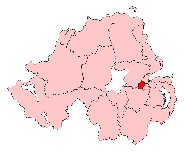
English: Map of the UK Parliament constituency of Belfast West within Northern Ireland. |
| Foinse | Obair féin |
| Údar | Wereon |
Ceadúnú
| I, the copyright holder of this work, release this work into the public domain. This applies worldwide. In some countries this may not be legally possible; if so: I grant anyone the right to use this work for any purpose, without any conditions, unless such conditions are required by law. |
Stair chomhaid
Cliceáil ar dáta/am chun an comhad a radharc mar a bhí sé ag an am sin.
| Dáta/Am | Mionsamhail | Toisí | Úsáideoir | Nóta tráchta | |
|---|---|---|---|---|---|
| faoi láthair | 11:11, 14 Bealtaine 2017 | | 779 × 635 (135 KB) | FlyingChrysalis | Current (2008) boundaries with old colours. Derived from File:United Kingdom general election, 2015 (Northern Ireland).svg |
| 17:11, 12 Bealtaine 2017 |  | 650 × 520 (150 KB) | FlyingChrysalis | Colours and 2010 boundaries | |
| 14:13, 1 Aibreán 2007 |  | 280 × 225 (87 KB) | Wereon | Map of the UK Parliament constituency of Belfast West within Northern Ireland. Category:Maps of Parliamentary constituencies in Northern Ireland |
.svg)
Úsáid comhaid
Níl nasc ó aon leathanach eile don íomhá seo.
Global file usage
The following other wikis use this file:
- Úsáid ar de.wikipedia.org
- Úsáid ar en.wikipedia.org
- Belfast West (UK Parliament constituency)
- List of parliamentary constituencies in Northern Ireland
- Belfast West (Assembly constituency)
- 5th Northern Ireland Assembly
- 6th Northern Ireland Assembly
- User:FlyingChrysalis/sandbox/For 5th NI Assembly
- User:FlyingChrysalis/sandbox/For 6th NI Assembly
- User:JamesHawkes0161/sandbox
- 7th Northern Ireland Assembly
- Úsáid ar fr.wikipedia.org
- Úsáid ar it.wikipedia.org
- Úsáid ar pl.wikipedia.org
- Úsáid ar simple.wikipedia.org
- Úsáid ar zh.wikipedia.org