Íomhá:Cooks Karte von Neufundland.jpg

Size of this preview: 615 × 599 picteilín. Other resolutions: 246 × 240 picteilín | 492 × 480 picteilín | 788 × 768 picteilín | 1,051 × 1,024 picteilín | 1,500 × 1,462 picteilín.
Taispeáin leagan ardtaifigh den íomhá (1,500 × 1,462 picteilín, méid comhaid: 521 KB, cineál MIME: image/jpeg)
| Seo comhad as An Cómhaoin Viciméid. Tá an tuairisc as an leathanach tuairisc Cómhaoin a leanas thíos.
|
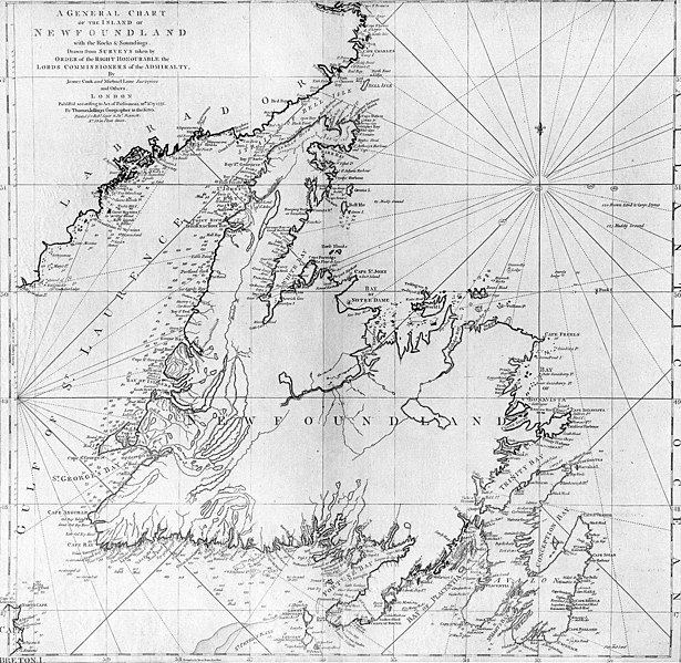
| Tuairisc | A general chart of the island of Newfoundland. Surveyed by James Cook and Michael Lane, and "publish'd according to Act of Parliament by Thomas Jefferys Geographer to the King, 1775." |
| Dáta | |
| Foinse | originally uploaded to en.wikipedia by Jcmurphy on 23 Apr 2005; copied from "Courtesy of the Centre for Newfoundland Studies, Memorial University of Newfoundland, St. John's, Newfoundland." |
| Údar | Michael Lane and James Cook |
| Ceadúnas (Athúsáid a bhaint as an gcomhad seo) |
Public domain because of age |
|
This work is in the public domain in its country of origin and other countries and areas where the copyright term is the author's life plus 100 years or fewer. | |
| This file has been identified as being free of known restrictions under copyright law, including all related and neighboring rights. | |
Stair chomhaid
Cliceáil ar dáta/am chun an comhad a radharc mar a bhí sé ag an am sin.
| Dáta/Am | Mionsamhail | Toisí | Úsáideoir | Nóta tráchta | |
|---|---|---|---|---|---|
| faoi láthair | 19:10, 6 Eanáir 2006 | | 1,500 × 1,462 (521 KB) | Schaengel89~commonswiki | {{Information| |Description =A general chart of the island of Newfoundland. Surveyed by James Cook and Michael Lane, and "publish'd according to Act of Parliament by Thomas Jefferys Geographer to the King, 1775." |Source =originally yuploaded to |
Úsáid comhaid
Tá nasc chuig an gcomhad seo ar na leathanaigh seo a leanas:
Global file usage
The following other wikis use this file:
- Úsáid ar bs.wikipedia.org
- Úsáid ar ca.wikipedia.org
- Úsáid ar de.wikipedia.org
- Úsáid ar en.wikipedia.org
- Úsáid ar en.wikivoyage.org
- Úsáid ar eo.wikipedia.org
- Úsáid ar es.wikipedia.org
- Úsáid ar fi.wikipedia.org
- Úsáid ar fr.wikipedia.org
- Úsáid ar fur.wikipedia.org
- Úsáid ar gl.wikipedia.org
- Úsáid ar he.wikipedia.org
- Úsáid ar hy.wikipedia.org
- Úsáid ar ia.wikipedia.org
- Úsáid ar it.wikipedia.org
- Úsáid ar ja.wikipedia.org
- Úsáid ar ka.wikipedia.org
- Úsáid ar ko.wikipedia.org
- Úsáid ar la.wikipedia.org
- Úsáid ar li.wikipedia.org
- Úsáid ar lt.wikipedia.org
- Úsáid ar mk.wikipedia.org
- Úsáid ar ne.wikipedia.org
- Úsáid ar no.wikipedia.org
- Úsáid ar oc.wikipedia.org
- Úsáid ar pl.wikipedia.org
- Úsáid ar pl.wiktionary.org
- Úsáid ar pt.wikipedia.org
View more global usage of this file.