Íomhá:Denbighshire UK location map.svg

Size of this PNG preview of this SVG file: 397 × 600 picteilín. Other resolutions: 159 × 240 picteilín | 318 × 480 picteilín | 508 × 768 picteilín | 678 × 1,024 picteilín | 1,356 × 2,048 picteilín | 864 × 1,305 picteilín.
Taispeáin leagan ardtaifigh den íomhá (Comhad SVG, ainmniúil 864 × 1,305 picteilíni, méid comhaid: 767 KB)
| Seo comhad as An Cómhaoin Viciméid. Tá an tuairisc as an leathanach tuairisc Cómhaoin a leanas thíos.
|
| Tuairisc |
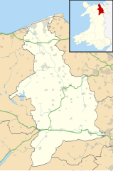
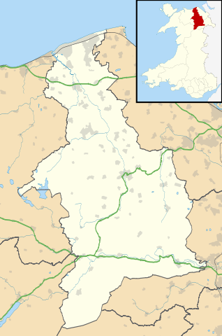
Blank map of Denbighshire, UK with the following information shown:
Equirectangular map projection on WGS 84 datum, with N/S stretched 165% Geographic limits:
|
| Dáta | |
| Foinse |
|
| Údar | Nilfanion, created using Ordnance Survey data |
| Ceadúnas (Athúsáid a bhaint as an gcomhad seo) |
This file is licensed under the Creative Commons Attribution-Share Alike 3.0 Unported license. Creidiúint: Contains Ordnance Survey data © Crown copyright and database right
|
| Leaganacha eile | File:Denbighshire UK map.svg - Blank map |
Stair chomhaid
Cliceáil ar dáta/am chun an comhad a radharc mar a bhí sé ag an am sin.
| Dáta/Am | Mionsamhail | Toisí | Úsáideoir | Nóta tráchta | |
|---|---|---|---|---|---|
| faoi láthair | 19:32, 26 Meán Fómhair 2010 | | 864 × 1,305 (767 KB) | Nilfanion | {{Information |Description=Blank map of Denbighshire, UK with the following information shown: *Administrative borders *Coastline, lakes and rivers *Roads and railways *Urban areas Equirectangular map projection on WGS 84 datum, with N |
Úsáid comhaid
Níl nasc ó aon leathanach eile don íomhá seo.
Global file usage
The following other wikis use this file:
- Úsáid ar ar.wikipedia.org
- Úsáid ar azb.wikipedia.org
- Úsáid ar ceb.wikipedia.org
- Úsáid ar cy.wikipedia.org
- Úsáid ar da.wikipedia.org
- Úsáid ar en.wikipedia.org
- Llangollen
- List of monastic houses in Wales
- Ruthin
- Denbighshire
- Rhyl
- St Asaph
- Prestatyn
- Rhuddlan
- Corwen
- Denbigh
- Bodelwyddan
- Gwyddelwern
- Loggerheads, Denbighshire
- Castell Dinas Brân
- Cynwyd, Denbighshire
- Nantglyn
- Llandyrnog
- Glyndyfrdwy
- Llanarmon-yn-Iâl
- Glan Clwyd Hospital
- Denbigh Community Hospital
- H.M. Stanley Hospital
- Llangollen Community Hospital
- Prestatyn Community Hospital
- Ruthin Community Hospital
- Pot Hole quarry
- Llandegla
- Henllan
- Meliden
- Dyserth
- Llanferres
- Llanelidan
- Tremeirchion
- Trefnant
- Llandrillo, Denbighshire
- Cader
- Bodfari
- Bontuchel
- Maeshafn
- RAF Prestatyn
- Llanfair Dyffryn Clwyd
- Tafarn-y-Gelyn
- Eryrys
- User:Arwel Parry/sandbox/Infobox Browser test
View more global usage of this file.