Íomhá:EnglandBerkshire.svg

Size of this PNG preview of this SVG file: 200 × 247 picteilín. Other resolutions: 194 × 240 picteilín | 389 × 480 picteilín | 622 × 768 picteilín | 829 × 1,024 picteilín | 1,658 × 2,048 picteilín.
Taispeáin leagan ardtaifigh den íomhá (Comhad SVG, ainmniúil 200 × 247 picteilíni, méid comhaid: 231 KB)
| Seo comhad as An Cómhaoin Viciméid. Tá an tuairisc as an leathanach tuairisc Cómhaoin a leanas thíos.
|
Achoimriú
| Tuairisc |
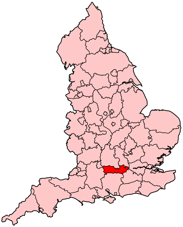
English: Map of the administrative county of Berkshire |
| Foinse | Obair féin |
| Údar | Wereon |
Ceadúnú
| I, the copyright holder of this work, release this work into the public domain. This applies worldwide. In some countries this may not be legally possible; if so: I grant anyone the right to use this work for any purpose, without any conditions, unless such conditions are required by law. |
Stair chomhaid
Cliceáil ar dáta/am chun an comhad a radharc mar a bhí sé ag an am sin.
| Dáta/Am | Mionsamhail | Toisí | Úsáideoir | Nóta tráchta | |
|---|---|---|---|---|---|
| faoi láthair | 20:05, 22 Aibreán 2007 | | 200 × 247 (231 KB) | Wereon | Map of the administrative county of Berkshire. Category:Maps of counties of England |
Úsáid comhaid
Níl nasc ó aon leathanach eile don íomhá seo.
Global file usage
The following other wikis use this file:
- Úsáid ar cy.wikipedia.org
- Reading
- Berkshire
- Eton
- Coleg Eton
- Windsor
- Castell Windsor
- Nodyn:Eginyn Berkshire
- Newbury, Berkshire
- Bracknell
- Earley
- Hungerford
- Maidenhead
- Sandhurst, Berkshire
- Slough
- Thatcham
- Wokingham
- Woodley, Berkshire
- Aldermaston
- Aldermaston Wharf
- Aldworth
- Amen Corner, Berkshire
- Anvilles
- Arborfield
- Arborfield Cross
- Arborfield Garrison
- Ascot, Berkshire
- Ashampstead
- Ashampstead Green
- Ashmore Green
- Aston, Berkshire
- Avington, Berkshire
- Bagnor
- Barkham
- Beansheaf Farm
- Beech Hill, Berkshire
- Beedon
- Beedon Common
- Beenham
- Beenham Stocks
- Benham Hill
- Billingbear
- Binfield
- Birch Hill
- Bisham
- Bloomfield Hatch
- Bothampstead
- Bowsey Hill
- Boxford, Berkshire
- Boyn Hill
- Bradfield, Berkshire
View more global usage of this file.