Íomhá:Graz - Schloßberg (b).JPG

Size of this preview: 800 × 422 picteilín. Other resolutions: 320 × 169 picteilín | 640 × 338 picteilín | 1,024 × 540 picteilín | 1,280 × 676 picteilín | 2,560 × 1,351 picteilín | 5,000 × 2,639 picteilín.
Taispeáin leagan ardtaifigh den íomhá (5,000 × 2,639 picteilín, méid comhaid: 8.99 MB, cineál MIME: image/jpeg)
| Seo comhad as An Cómhaoin Viciméid. Tá an tuairisc as an leathanach tuairisc Cómhaoin a leanas thíos.
|
Achoimriú
| Tuairisc |
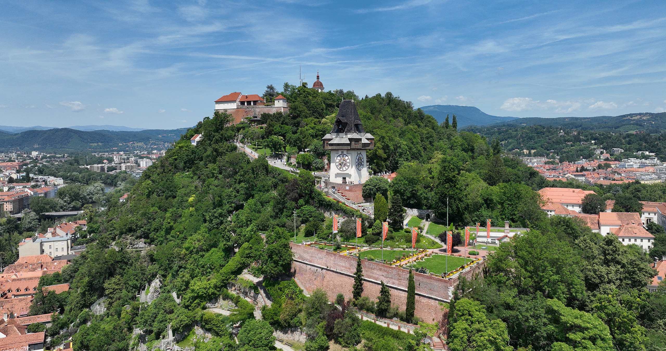
Deutsch: Südansicht des Schloßberges in der steirischen Landeshauptstadt Graz und im Vordergrund die Bürgerbastei mit einer Beflaggung für die Styriarte sowie der Uhrturm.
Der Schloßberg in Graz bildet mit 123 Metern Höhe, ausgehend vom Grazer Hauptplatz, den höchsten natürlichen Punkt der Stadt. Ab dem 12. Jahrhundert wurde auf dem Berg eine Burg errichtet, die nie erobert wurde. Im Zuge der Napoleonischen Kriege wurde sie großteils gesprengt und abgetragen. Der befestigte mittelalterliche Uhrturm erhielt seine heutige Form um 1560 und ist das Wahrzeichen von Graz. Seine charakteristische Holzgalerie diente als Rundgang der Feuerwache: [1], [2]. English: South view of the Schlossberg in Graz, Austria. |
| Dáta | |
| Foinse | Obair féin |
| Údar | C.Stadler/Bwag |
| Ceadúnas (Athúsáid a bhaint as an gcomhad seo) |
Deutsch: Hallo, du darfst mein Foto kostenlos nutzen, aber nenne mich bitte als Fotograf, beispielsweise „Foto: C.Stadler/Bwag“ oder © C.Stadler/Bwag; CC-BY-SA-4.0. Auf mehr Angaben bestehe ich nicht - im Gegensatz zu manch anderen, die die Vorgaben der unten angeführten Lizenzierung auf Punkt und Beistrich einfordern. English: Feel free to use my photos, but please mention me as the author like © C.Stadler/Bwag or © C.Stadler/Bwag; CC-BY-SA-4.0 (that's good enough) and if you want send me a message: bwag@gmx.net. |
| Leaganacha eile |
|
.JPG)
.JPG)
.JPG)
.JPG)
.JPG)
| Object location | | View this and other nearby images on: OpenStreetMap |
|---|
.JPG¶ms=047.073560_N_0015.437710_E_globe:Earth_class:object_type:object__&language=ga)
| Camera location | | View this and other nearby images on: OpenStreetMap |
|---|
.JPG¶ms=047.072250_N_0015.437830_E_globe:Earth_type:camera_heading:355.00&language=ga)
Ceadúnú
Is mise sealbhóir cóipchirt an shaothair seo agus foilsím é faoin gceadúnas seo a leanas:
This file is licensed under the Creative Commons Attribution-Share Alike 4.0 International license.
- Is féidir:
- an saothar seo a roinnt – an saothar seo a chóipeáil, a dháil amach, agus a tharchur
- an saothar seo a athmheascadh – an saothar seo a oiriúnú
- Ach amháin má leantar na coinníollacha seo a leanas:
- sannadh – Ní mor creidiúint a thabhairt leis an saothar, faoi mar a shonraigh an údar nó tabharthóir an ceadúnais (ach ná húsáid modh a thugann le fios go thacaíonn sé/sí tú féin nó an úsáid a bhaineann tú as an saothar).
- comhroinn araon – Má athraíonn tú nó síneann tú amach an saothar seo, ní féidir é a dháileadh ach amhaín faoin gceadúnas céanna nó ceann cosúil leis an gceann seo.
| Annotations | This image is annotated: View the annotations at Commons |
Stair chomhaid
Cliceáil ar dáta/am chun an comhad a radharc mar a bhí sé ag an am sin.
| Dáta/Am | Mionsamhail | Toisí | Úsáideoir | Nóta tráchta | |
|---|---|---|---|---|---|
| faoi láthair | 21:12, 20 Meitheamh 2022 | | 5,000 × 2,639 (8.99 MB) | Bwag | == {{int:filedesc}} == {{Information |Description= {{de|1= Südansicht des Schloßberges in der steirischen Landeshauptstadt Graz und im Vordergrund die Bürgerbastei mit einer Beflaggung für die Styriarte sowie der Uhrturm.<br/>Der Schloßberg in Graz bildet mit 123 Metern Höhe, ausgehend vom Grazer Hauptplatz, den höchsten natürlichen Punkt der Stadt. Ab dem 12. Jahrhundert wurde auf dem Berg eine Burg errichtet, die nie erobert wurde. Im Zuge der Napoleonischen Kriege wurde... |
Úsáid comhaid
Níl nasc ó aon leathanach eile don íomhá seo.
Global file usage
The following other wikis use this file:
- Úsáid ar de.wikipedia.org
- Úsáid ar es.wikipedia.org
- Úsáid ar ru.wikipedia.org
.JPG)