Íomhá:LocatieHarenkarspel.png
Níl aon taifeach is mó ar fáil.
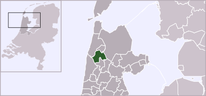
LocatieHarenkarspel.png (421 × 196 picteilín, méid comhaid: 28 KB, cineál MIME: image/png)
| Seo comhad as An Cómhaoin Viciméid. Tá an tuairisc as an leathanach tuairisc Cómhaoin a leanas thíos.
|
| Tuairisc | Locator map of Dutch municipalities in Noord-Holland (LocatieHarenkarspel.png) | ||
| Foinse | own drawing. Originally uploaded as w:nl:afbeelding:LocatieHarenkarspel.png | ||
| Údar | Mtcv (2003/2004) | ||
| Ceadúnas (Athúsáid a bhaint as an gcomhad seo) |
|
Stair chomhaid
Cliceáil ar dáta/am chun an comhad a radharc mar a bhí sé ag an am sin.
| Dáta/Am | Mionsamhail | Toisí | Úsáideoir | Nóta tráchta | |
|---|---|---|---|---|---|
| faoi láthair | 18:48, 3 Feabhra 2012 | | 421 × 196 (28 KB) | Gladiool | Increased size + 2012 municipality borders |
| 13:07, 28 Bealtaine 2006 |  | 280 × 130 (9 KB) | Commonsfreak~commonswiki | {{Information |Description=Locator map of Dutch municipalities in Noord-Holland ({{Subst:PAGENAME}}) |Source= own drawing. Originally uploaded as [[:w:nl:afbeelding:{{subst:PAGENAME}}]] |Date= |Author=Mtcv (2003/2004) |Permission |
Úsáid comhaid
Tá nasc chuig an gcomhad seo ar na leathanaigh seo a leanas:
Global file usage
The following other wikis use this file:
- Úsáid ar ca.wikipedia.org
- Úsáid ar de.wikipedia.org
- Úsáid ar en.wikipedia.org
- Úsáid ar eo.wikipedia.org
- Úsáid ar es.wikipedia.org
- Úsáid ar eu.wikipedia.org
- Úsáid ar fa.wikipedia.org
- Úsáid ar fr.wikipedia.org
- Úsáid ar fy.wikipedia.org
- Úsáid ar jv.wikipedia.org
- Úsáid ar nds-nl.wikipedia.org
- Úsáid ar pt.wikipedia.org
- Úsáid ar ro.wikipedia.org
- Úsáid ar ru.wikipedia.org
- Úsáid ar sv.wikipedia.org
- Úsáid ar www.wikidata.org
- Úsáid ar zea.wikipedia.org