Íomhá:Map of Geneva in 1841.jpg
Size of this preview: 765 × 600 picteilín. Other resolutions: 306 × 240 picteilín | 612 × 480 picteilín | 980 × 768 picteilín | 1,280 × 1,004 picteilín | 1,306 × 1,024 picteilín.
Taispeáin leagan ardtaifigh den íomhá (1,306 × 1,024 picteilín, méid comhaid: 1.01 MB, cineál MIME: image/jpeg)
| Seo comhad as An Cómhaoin Viciméid. Tá an tuairisc as an leathanach tuairisc Cómhaoin a leanas thíos.
|
Achoimriú
| Tuairisc |
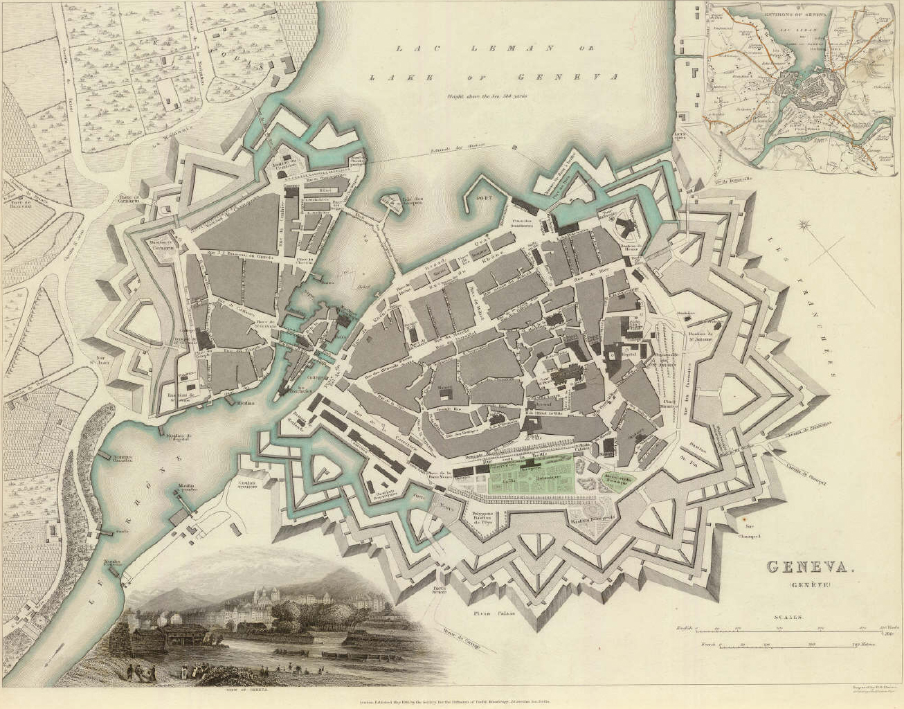
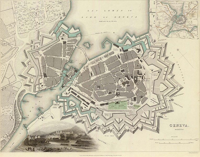
English: Plan of Geneva (Switzerland) and environs, showing the massive fortifications less than ten years before the start of their demolition in 1850. |
| Dáta | |
| Foinse | Own work by uploader. Print in private possession. |
| Údar | Scan by Nick Michael. Oiginal author B. R. Davies (1841) |
| Leaganacha eile | http://www.atlassen.info/kaarten/algemeen/sduk/sdukp.html |
Ceadúnú
Is mise sealbhóir cóipchirt an shaothair seo agus foilsím é faoi na ceadúnais seo a leanas:
This file is licensed under the Creative Commons Attribution-Share Alike 3.0 Unported license.
- Is féidir:
- an saothar seo a roinnt – an saothar seo a chóipeáil, a dháil amach, agus a tharchur
- an saothar seo a athmheascadh – an saothar seo a oiriúnú
- Ach amháin má leantar na coinníollacha seo a leanas:
- sannadh – Ní mor creidiúint a thabhairt leis an saothar, faoi mar a shonraigh an údar nó tabharthóir an ceadúnais (ach ná húsáid modh a thugann le fios go thacaíonn sé/sí tú féin nó an úsáid a bhaineann tú as an saothar).
- comhroinn araon – Má athraíonn tú nó síneann tú amach an saothar seo, ní féidir é a dháileadh ach amhaín faoin gceadúnas céanna nó ceann cosúil leis an gceann seo.

|
Tugtar cead an doiciméad seo a chóipeáil, a dháileadh agus/nó a mhodhnú faoi théarmaí an Ceadúnas Doiciméadúcháin Saor ó GNU, Leagan 1.2 nó aon leagan níos déanaí a d’fhoilsigh an Fondúireacht Bogearraí Saor in Aisce; gan aon Rannóga Inmheánacha, gan aon Téacsanna Clúdaigh Tosaigh, agus gan aon Téacsanna Clúdaigh Cúil. Tá cóip den cheadúnas san áireamh sa chuid dar teideal Ceadúnas Doiciméadúcháin Saor ó GNU. |
Is féidir leat a roghnú an ceadúnas do rogha
Stair chomhaid
Cliceáil ar dáta/am chun an comhad a radharc mar a bhí sé ag an am sin.
| Dáta/Am | Mionsamhail | Toisí | Úsáideoir | Nóta tráchta | |
|---|---|---|---|---|---|
| faoi láthair | 18:39, 5 Lúnasa 2009 | | 1,306 × 1,024 (1.01 MB) | Nick Michael | {{Information |Description={{en|1=Plan of Geneva (Switzerland) and environs, showing the massive fortifications les than ten years before the start of their demolition in 1850.}} |Source=Own work by uploader. Print in private possession. |Author=Scan by N |
Úsáid comhaid
Tá nasc chuig an gcomhad seo ar na leathanaigh seo a leanas:
Global file usage
The following other wikis use this file:
- Úsáid ar az.wikipedia.org
- Úsáid ar bg.wikipedia.org
- Úsáid ar cs.wikipedia.org
- Úsáid ar de.wikipedia.org
- Úsáid ar es.wikipedia.org
- Úsáid ar fa.wikipedia.org
- Úsáid ar he.wikipedia.org
- Úsáid ar he.wikivoyage.org
- Úsáid ar id.wikipedia.org
- Úsáid ar ja.wikipedia.org
- Úsáid ar la.wikipedia.org
- Úsáid ar ro.wikipedia.org
- Úsáid ar ru.wikipedia.org
- Úsáid ar sl.wikipedia.org
- Úsáid ar sv.wikipedia.org
- Úsáid ar ta.wikipedia.org
- Úsáid ar tr.wikipedia.org
- Úsáid ar tt.wikipedia.org