Íomhá:Map of Pennsylvania highlighting Tioga County.svg

Size of this PNG preview of this SVG file: 800 × 460 picteilín. Other resolutions: 320 × 184 picteilín | 640 × 368 picteilín | 1,024 × 589 picteilín | 1,280 × 736 picteilín | 2,560 × 1,472 picteilín | 4,950 × 2,846 picteilín.
Taispeáin leagan ardtaifigh den íomhá (Comhad SVG, ainmniúil 4,950 × 2,846 picteilíni, méid comhaid: 106 KB)
| Seo comhad as An Cómhaoin Viciméid. Tá an tuairisc as an leathanach tuairisc Cómhaoin a leanas thíos.
|
Achoimriú
| Tuairisc |
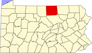
Locator map of Tioga County — in northern Pennsylvania.
|
| Dáta | 12 Feabhra 2006 (original upload date) |
| Foinse | No machine-readable source provided. Own work assumed (based on copyright claims). |
| Údar | No machine-readable author provided. David Benbennick assumed (based on copyright claims). |
| SVG genesis |
Ceadúnú
| I, the copyright holder of this work, release this work into the public domain. This applies worldwide. In some countries this may not be legally possible; if so: I grant anyone the right to use this work for any purpose, without any conditions, unless such conditions are required by law. |
Stair chomhaid
Cliceáil ar dáta/am chun an comhad a radharc mar a bhí sé ag an am sin.
| Dáta/Am | Mionsamhail | Toisí | Úsáideoir | Nóta tráchta | |
|---|---|---|---|---|---|
| faoi láthair | 16:23, 12 Feabhra 2006 | | 4,950 × 2,846 (106 KB) | David Benbennick | {{subst:User:Dbenbenn/clm|county=Tioga County|state=Pennsylvania|type=county}} |
Úsáid comhaid
Tá nasc chuig an gcomhad seo ar na leathanaigh seo a leanas:
Global file usage
The following other wikis use this file:
- Úsáid ar ar.wikipedia.org
- Úsáid ar bg.wikipedia.org
- Úsáid ar bpy.wikipedia.org
- Úsáid ar cdo.wikipedia.org
- Úsáid ar ceb.wikipedia.org
- Úsáid ar cy.wikipedia.org
- Úsáid ar de.wikipedia.org
- Úsáid ar en.wikipedia.org
- List of counties in Pennsylvania
- Tioga County, Pennsylvania
- Bloss Township, Pennsylvania
- Blossburg, Pennsylvania
- Brookfield Township, Pennsylvania
- Charleston Township, Tioga County, Pennsylvania
- Chatham Township, Tioga County, Pennsylvania
- Clymer Township, Tioga County, Pennsylvania
- Covington Township, Tioga County, Pennsylvania
- Deerfield Township, Tioga County, Pennsylvania
- Delmar Township, Tioga County, Pennsylvania
- Duncan Township, Tioga County, Pennsylvania
- Elk Township, Tioga County, Pennsylvania
- Elkland, Pennsylvania
- Farmington Township, Tioga County, Pennsylvania
- Gaines Township, Tioga County, Pennsylvania
- Hamilton Township, Tioga County, Pennsylvania
- Jackson Township, Tioga County, Pennsylvania
- Knoxville, Pennsylvania
- Lawrence Township, Tioga County, Pennsylvania
- Lawrenceville, Pennsylvania
- Liberty, Tioga County, Pennsylvania
- Liberty Township, Tioga County, Pennsylvania
- Mansfield, Pennsylvania
- Middlebury Township, Pennsylvania
- Morris Township, Tioga County, Pennsylvania
- Nelson Township, Pennsylvania
- Osceola Township, Pennsylvania
- Putnam Township, Pennsylvania
- Richmond Township, Tioga County, Pennsylvania
- Roseville, Pennsylvania
- Rutland Township, Pennsylvania
- Shippen Township, Tioga County, Pennsylvania
- Sullivan Township, Pennsylvania
- Tioga, Pennsylvania
- Tioga Township, Tioga County, Pennsylvania
- Union Township, Tioga County, Pennsylvania
- Ward Township, Pennsylvania
View more global usage of this file.