Íomhá:Map of the Dublin Region2.PNG
Níl aon taifeach is mó ar fáil.
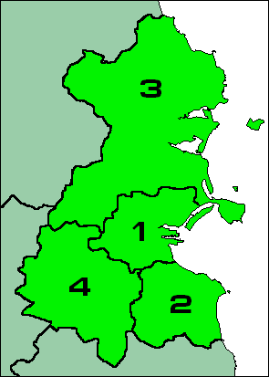
Map_of_the_Dublin_Region2.PNG (295 × 413 picteilín, méid comhaid: 8 KB, cineál MIME: image/png)
| Seo comhad as An Cómhaoin Viciméid. Tá an tuairisc as an leathanach tuairisc Cómhaoin a leanas thíos.
|

|
This locator map image could be re-created using vector graphics as an SVG file. This has several advantages; see Commons:Media for cleanup for more information. If an SVG form of this image is available, please upload it and afterwards replace this template with
{{vector version available|new image name}}.
It is recommended to name the SVG file “Map of the Dublin Region2.svg”—then the template Vector version available (or Vva) does not need the new image name parameter. |
Achoimriú
From english wikipedia
| This work has been released into the public domain by its author, LocGov. This applies worldwide. In some countries this may not be legally possible; if so: |
Stair chomhaid
Cliceáil ar dáta/am chun an comhad a radharc mar a bhí sé ag an am sin.
| Dáta/Am | Mionsamhail | Toisí | Úsáideoir | Nóta tráchta | |
|---|---|---|---|---|---|
| faoi láthair | 11:22, 16 Eanáir 2006 | | 295 × 413 (8 KB) | Mikel | From english wikipedia {{PD}} |
Úsáid comhaid
Tá nasc chuig an gcomhad seo ar na leathanaigh seo a leanas:
Global file usage
The following other wikis use this file:
- Úsáid ar ast.wikipedia.org
- Úsáid ar bg.wikipedia.org
- Úsáid ar br.wikipedia.org
- Úsáid ar ca.wikipedia.org
- Úsáid ar da.wikipedia.org
- Úsáid ar en.wikipedia.org
- Úsáid ar es.wikipedia.org
- Úsáid ar et.wikipedia.org
- Úsáid ar eu.wikipedia.org
- Úsáid ar fa.wikipedia.org
- Úsáid ar fr.wikivoyage.org
- Úsáid ar gv.wikipedia.org
- Úsáid ar he.wikipedia.org
- Úsáid ar it.wikipedia.org
- Úsáid ar ja.wikipedia.org
- Úsáid ar ka.wikipedia.org
- Úsáid ar la.wikipedia.org
- Úsáid ar lt.wikipedia.org
- Úsáid ar mk.wikipedia.org
- Úsáid ar nn.wikipedia.org
- Úsáid ar pt.wikipedia.org
- Úsáid ar ru.wikipedia.org
- Úsáid ar sr.wikipedia.org
- Úsáid ar uk.wikipedia.org