Íomhá:Northlasv.jpg
Size of this preview: 800 × 292 picteilín. Other resolutions: 320 × 117 picteilín | 1,011 × 369 picteilín.
Taispeáin leagan ardtaifigh den íomhá (1,011 × 369 picteilín, méid comhaid: 123 KB, cineál MIME: image/jpeg)
| Seo comhad as An Cómhaoin Viciméid. Tá an tuairisc as an leathanach tuairisc Cómhaoin a leanas thíos.
|
Achoimriú
| Tuairisc |
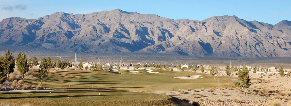
English: The southern section of the Las Vegas Range, and the Aliante Golf Club in the Las Vegas Valley — in Clark County, southern Nevada.
|
| Foinse | Obair féin |
| Údar | Meridethmyers |
Ceadúnú
| I, the copyright holder of this work, release this work into the public domain. This applies worldwide. In some countries this may not be legally possible; if so: I grant anyone the right to use this work for any purpose, without any conditions, unless such conditions are required by law. |
Stair chomhaid
Cliceáil ar dáta/am chun an comhad a radharc mar a bhí sé ag an am sin.
| Dáta/Am | Mionsamhail | Toisí | Úsáideoir | Nóta tráchta | |
|---|---|---|---|---|---|
| faoi láthair | 22:04, 3 Bealtaine 2008 | 1,011 × 369 (123 KB) | Meridethmyers~commonswiki | {{Information |Description= |Source=self-made |Date= |Author= Meridethmyers |Permission= |other_versions= }} |
Úsáid comhaid
Níl nasc ó aon leathanach eile don íomhá seo.
Global file usage
The following other wikis use this file:
- Úsáid ar ar.wikipedia.org
- Úsáid ar arz.wikipedia.org
- Úsáid ar azb.wikipedia.org
- Úsáid ar be-tarask.wikipedia.org
- Úsáid ar br.wikipedia.org
- Úsáid ar bs.wikipedia.org
- Úsáid ar ceb.wikipedia.org
- Úsáid ar de.wikipedia.org
- Úsáid ar en.wikipedia.org
- Úsáid ar en.wikivoyage.org
- Úsáid ar eo.wikipedia.org
- Úsáid ar es.wikipedia.org
- Úsáid ar fa.wikipedia.org
- Úsáid ar fi.wikipedia.org
- Úsáid ar fr.wikipedia.org
- Úsáid ar id.wikipedia.org
- Úsáid ar ja.wikipedia.org
- Úsáid ar kw.wikipedia.org
- Úsáid ar no.wikipedia.org
- Úsáid ar pms.wikipedia.org
- Úsáid ar pt.wikipedia.org
- Úsáid ar ru.wikipedia.org
- Úsáid ar simple.wikipedia.org
- Úsáid ar sw.wikipedia.org
- Úsáid ar tl.wikipedia.org
- Úsáid ar tr.wikipedia.org
- Úsáid ar uk.wikipedia.org
- Úsáid ar uz.wikipedia.org
- Úsáid ar war.wikipedia.org
- Úsáid ar www.wikidata.org
- Úsáid ar zh.wikipedia.org