Íomhá:West Midlands County.png
Size of this preview: 800 × 582 picteilín. Other resolutions: 320 × 233 picteilín | 640 × 466 picteilín | 1,024 × 745 picteilín | 1,280 × 931 picteilín | 2,560 × 1,862 picteilín | 3,358 × 2,443 picteilín.
Taispeáin leagan ardtaifigh den íomhá (3,358 × 2,443 picteilín, méid comhaid: 868 KB, cineál MIME: image/png)
| Seo comhad as An Cómhaoin Viciméid. Tá an tuairisc as an leathanach tuairisc Cómhaoin a leanas thíos.
|
Achoimriú
| Tuairisc |
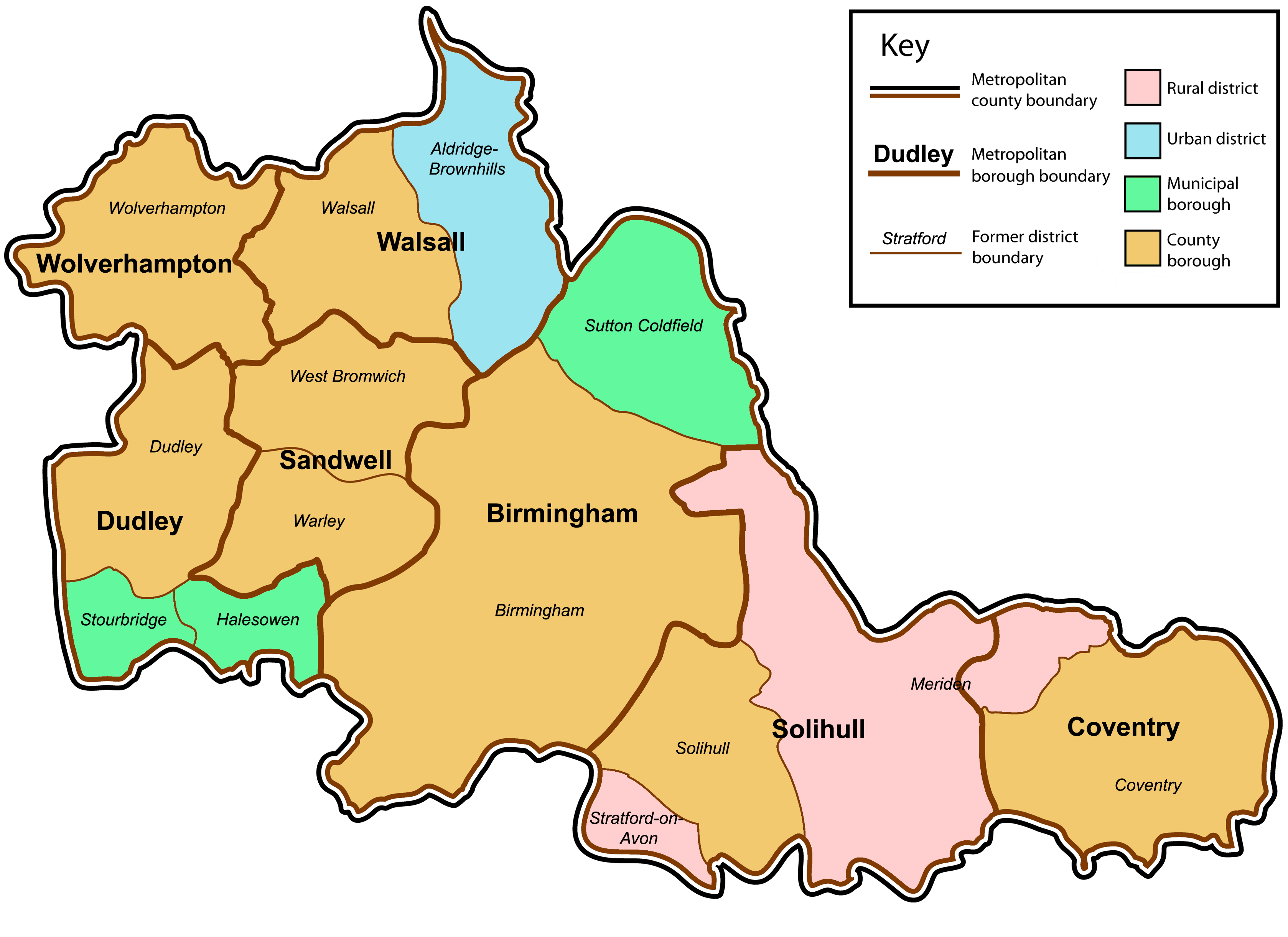
English: A map of the metropolitan county of West Midlands, England. This map shows former and modern district boundaries. For an explanation of the colours, see the key. |
| Dáta | |
| Foinse | Own work by uploader. Content is verified at Her Majesty's Stationery Office (1974) Local Government in England and Wales: A Guide to the New System, Londain: HMSO ISBN: 0117508470. |
| Údar | Jza84 |
Ceadúnú
| I, the copyright holder of this work, release this work into the public domain. This applies worldwide. In some countries this may not be legally possible; if so: I grant anyone the right to use this work for any purpose, without any conditions, unless such conditions are required by law. |
Stair chomhaid
Cliceáil ar dáta/am chun an comhad a radharc mar a bhí sé ag an am sin.
| Dáta/Am | Mionsamhail | Toisí | Úsáideoir | Nóta tráchta | |
|---|---|---|---|---|---|
| faoi láthair | 01:08, 14 Eanáir 2009 | | 3,358 × 2,443 (868 KB) | Jza84 | fix Meriden and Stratford-on-Avon |
| 14:43, 13 Eanáir 2009 |  | 3,358 × 2,443 (866 KB) | Jza84 | {{Information |Description={{en|1=A map of the metropolitan county of West Midlands, England. This map shows former and modern district boundaries. For an explanation of the colours, see the key.}} |Source=Own work by uploader |Author=Jza84 |
Úsáid comhaid
Níl nasc ó aon leathanach eile don íomhá seo.
Global file usage
The following other wikis use this file:
- Úsáid ar en.wikipedia.org
- Úsáid ar it.wikipedia.org