Íomhá:Angus UK relief location map.jpg

Size of this preview: 611 × 600 picteilín. Other resolutions: 244 × 240 picteilín | 489 × 480 picteilín | 782 × 768 picteilín | 1,043 × 1,024 picteilín | 1,998 × 1,962 picteilín.
Taispeáin leagan ardtaifigh den íomhá (1,998 × 1,962 picteilín, méid comhaid: 471 KB, cineál MIME: image/jpeg)
| Seo comhad as An Cómhaoin Viciméid. Tá an tuairisc as an leathanach tuairisc Cómhaoin a leanas thíos.
|
| Tuairisc |
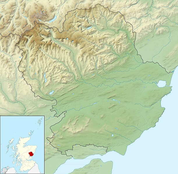
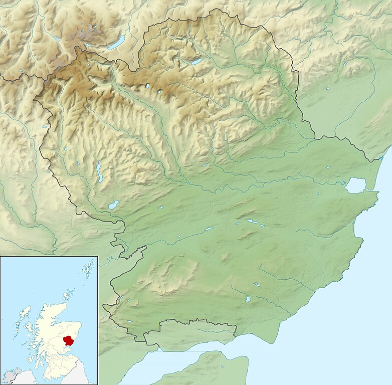
Relief map of Angus, UK. Equirectangular map projection on WGS 84 datum, with N/S stretched 180% Geographic limits:
|
| Dáta | |
| Foinse |
|
| Údar | Nilfanion, created using Ordnance Survey data |
| Ceadúnas (Athúsáid a bhaint as an gcomhad seo) |
This file is licensed under the Creative Commons Attribution-Share Alike 3.0 Unported license. Creidiúint: Contains Ordnance Survey data © Crown copyright and database right
|
| Leaganacha eile | File:Angus UK blank map.svg - Blank map |
Stair chomhaid
Cliceáil ar dáta/am chun an comhad a radharc mar a bhí sé ag an am sin.
| Dáta/Am | Mionsamhail | Toisí | Úsáideoir | Nóta tráchta | |
|---|---|---|---|---|---|
| faoi láthair | 12:15, 30 Samhain 2011 | | 1,998 × 1,962 (471 KB) | Nilfanion | {{Information |Description=Relief map of Angus, UK. Equirectangular map projection on WGS 84 datum, with N/S stretched 180% Geographic limits: *West: 3.5W *East: 2.4W *North: 57.0N *South: 56.4N |Source=Ordnance Survey |
Úsáid comhaid
Tá nasc chuig an gcomhad seo ar na leathanaigh seo a leanas:
Global file usage
The following other wikis use this file:
- Úsáid ar ar.wikipedia.org
- Úsáid ar ba.wikipedia.org
- Úsáid ar bg.wikipedia.org
- Úsáid ar ceb.wikipedia.org
- Úsáid ar de.wikipedia.org
- Airlie Castle
- Cortachy Castle
- Edzell Castle
- Vorlage:Positionskarte Schottland Angus
- Finavon Castle
- Farnell Castle
- Forter Castle
- Forfar Castle
- Gardyne Castle
- Invermark Castle
- Inverquharity Castle
- Melgund Castle
- Panmure Castle
- Red Castle
- Glas Maol
- Cairn of Claise
- Creag Leacach
- Tom Buidhe
- Driesh
- Mayar
- Loch of Forfar
- Úsáid ar en.wikipedia.org
- Sidlaws
- Carnoustie Golf Links
- 2007 Open Championship
- Loch Lee
- Corrie Fee
- Balfour Castle, Angus
- User:Catfish Jim and the soapdish/Double Disc (Pictish symbol)
- Module:Location map/data/Scotland Angus/doc
- Rescobie Loch
- Loch Fithie
- Loch of Forfar
- 2018 Open Championship
- West Seaton House
- Module:Location map/data/Scotland Angus
- 2010 Senior Open Championship
- Loch of Lintrathen
- Long Loch (Angus)
View more global usage of this file.