Íomhá:Canvey Island OSM map 2010.jpg

Size of this preview: 778 × 599 picteilín. Other resolutions: 312 × 240 picteilín | 623 × 480 picteilín | 997 × 768 picteilín | 1,062 × 818 picteilín.
Taispeáin leagan ardtaifigh den íomhá (1,062 × 818 picteilín, méid comhaid: 141 KB, cineál MIME: image/jpeg)
| Seo comhad as An Cómhaoin Viciméid. Tá an tuairisc as an leathanach tuairisc Cómhaoin a leanas thíos.
|
| Tuairisc |
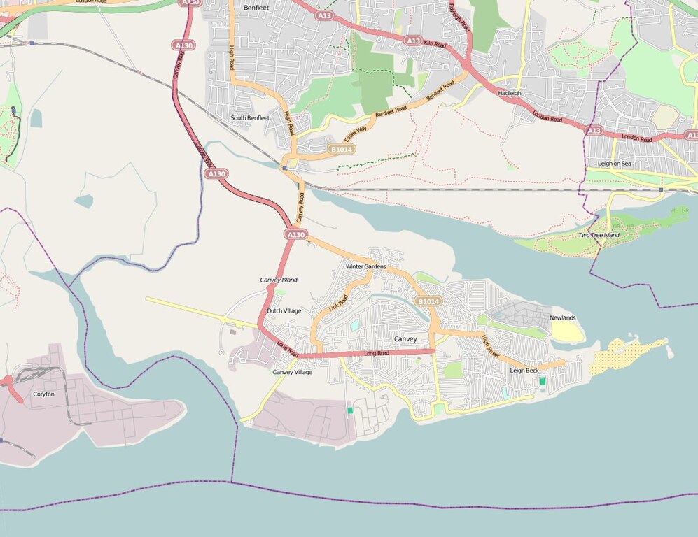
English: Map of Canvey Island (Essex, United Kingdom) and its surrounding areas. |
| Dáta | |
| Foinse | OpenStreetMap |
| Údar | The OpenStreetMap Project. |
| Ceadúnas (Athúsáid a bhaint as an gcomhad seo) |
This file is licensed under the Creative Commons Attribution 2.0 Generic license.
|
Stair chomhaid
Cliceáil ar dáta/am chun an comhad a radharc mar a bhí sé ag an am sin.
| Dáta/Am | Mionsamhail | Toisí | Úsáideoir | Nóta tráchta | |
|---|---|---|---|---|---|
| faoi láthair | 16:14, 2 Meitheamh 2010 | | 1,062 × 818 (141 KB) | Oneblackline | {{Information |Description={{en|1=Map of Canvey Island (Essex, United Kingdom) and its surrounding areas.}} |Source=[http://www.openstreetmap.org/?lat=51.5311&lon=0.5752&zoom=13&layers=B000FTFT OpenStreetMap] |Author=The OpenStreetMap |
Úsáid comhaid
Níl nasc ó aon leathanach eile don íomhá seo.
Global file usage
The following other wikis use this file:
- Úsáid ar arz.wikipedia.org
- Úsáid ar azb.wikipedia.org
- Úsáid ar ceb.wikipedia.org
- Úsáid ar en.wikipedia.org
- Úsáid ar et.wikipedia.org
- Úsáid ar fa.wikipedia.org
- Úsáid ar lld.wikipedia.org
- Úsáid ar pl.wikipedia.org
- Úsáid ar sh.wikipedia.org
- Úsáid ar te.wikipedia.org
- Úsáid ar vo.wikipedia.org
- Úsáid ar www.wikidata.org
- Úsáid ar yi.wikipedia.org
- Úsáid ar zh.wikipedia.org