Íomhá:Colombia relief location map.jpg

Size of this preview: 530 × 600 picteilín. Other resolutions: 212 × 240 picteilín | 424 × 480 picteilín | 679 × 768 picteilín | 905 × 1,024 picteilín | 2,028 × 2,294 picteilín.
Taispeáin leagan ardtaifigh den íomhá (2,028 × 2,294 picteilín, méid comhaid: 1.1 MB, cineál MIME: image/jpeg)
| Seo comhad as An Cómhaoin Viciméid. Tá an tuairisc as an leathanach tuairisc Cómhaoin a leanas thíos.
|
Achoimriú


.svg)


|
This map has been made or improved in the German Kartenwerkstatt (Map Lab). You can propose maps to improve as well.
|
Ceadúnú
Is mise sealbhóir cóipchirt an shaothair seo agus foilsím é faoin gceadúnas seo a leanas:
This file is licensed under the Creative Commons Attribution-Share Alike 3.0 Unported license.
- Is féidir:
- an saothar seo a roinnt – an saothar seo a chóipeáil, a dháil amach, agus a tharchur
- an saothar seo a athmheascadh – an saothar seo a oiriúnú
- Ach amháin má leantar na coinníollacha seo a leanas:
- sannadh – Ní mor creidiúint a thabhairt leis an saothar, faoi mar a shonraigh an údar nó tabharthóir an ceadúnais (ach ná húsáid modh a thugann le fios go thacaíonn sé/sí tú féin nó an úsáid a bhaineann tú as an saothar).
- comhroinn araon – Má athraíonn tú nó síneann tú amach an saothar seo, ní féidir é a dháileadh ach amhaín faoin gceadúnas céanna nó ceann cosúil leis an gceann seo.
Stair chomhaid
Cliceáil ar dáta/am chun an comhad a radharc mar a bhí sé ag an am sin.
| Dáta/Am | Mionsamhail | Toisí | Úsáideoir | Nóta tráchta | |
|---|---|---|---|---|---|
| faoi láthair | 06:53, 16 Feabhra 2015 | | 2,028 × 2,294 (1.1 MB) | Milenioscuro | same dimensions of locator map.svg |
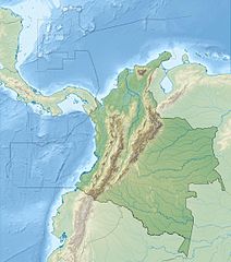
| 12:38, 6 Feabhra 2010 |  | 1,516 × 1,736 (901 KB) | Alexrk2 | {{Information |Description= {{de|Physische Positionskarte von Kolumbien Quadratische Plattkarte. Geographische Begrenzung der Karte:}} {{en|Physical Location map of Colombia Equirectangular projection. Geographic limits |
Úsáid comhaid
Níl nasc ó aon leathanach eile don íomhá seo.
Global file usage
The following other wikis use this file:
- Úsáid ar als.wikipedia.org
- Úsáid ar ar.wikipedia.org
- Úsáid ar ast.wikipedia.org
- Úsáid ar avk.wikipedia.org
- Úsáid ar azb.wikipedia.org
- Úsáid ar az.wikipedia.org
- Úsáid ar ban.wikipedia.org
- Úsáid ar ba.wikipedia.org
- Úsáid ar be.wikipedia.org
- Úsáid ar bg.wikipedia.org
View more global usage of this file.