Íomhá:European Provinces of the Roman Empire.jpg

Taispeáin leagan ardtaifigh den íomhá (2,301 × 1,798 picteilín, méid comhaid: 849 KB, cineál MIME: image/jpeg)
| Seo comhad as An Cómhaoin Viciméid. Tá an tuairisc as an leathanach tuairisc Cómhaoin a leanas thíos.
|
Achoimriú
| Tuairisc |
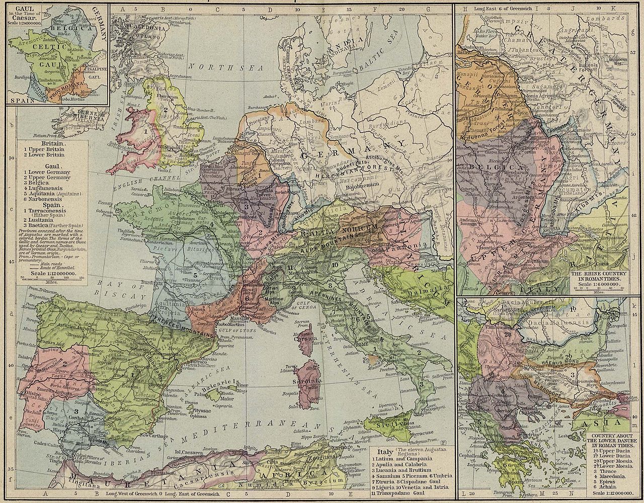
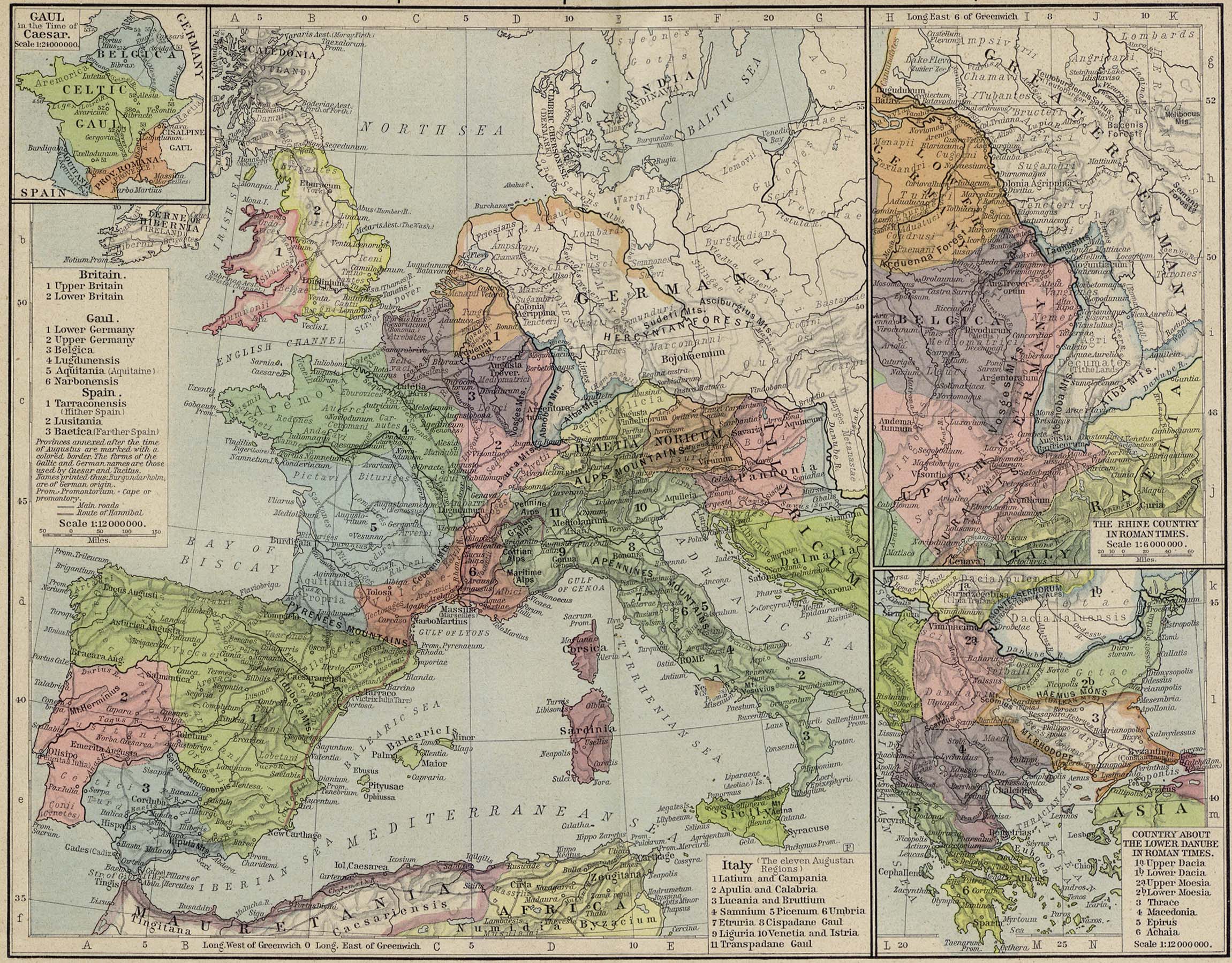
English: Reference Map of the European Provinces of the Roman Empire by William R. Shepherd
|
||||||||||||||||||||||
| Dáta | |||||||||||||||||||||||
| Foinse | downloaded from european_provinces_rome.jpg, following a link from history_shepherd_1923.html at http://www.lib.utexas.edu | ||||||||||||||||||||||
| Údar |
|
||||||||||||||||||||||
| Ceadúnas (Athúsáid a bhaint as an gcomhad seo) |
|
||||||||||||||||||||||
| Leaganacha eile |
|
||||||||||||||||||||||
.jpg)


Stair chomhaid
Cliceáil ar dáta/am chun an comhad a radharc mar a bhí sé ag an am sin.
| Dáta/Am | Mionsamhail | Toisí | Úsáideoir | Nóta tráchta | |
|---|---|---|---|---|---|
| faoi láthair | 19:06, 23 Lúnasa 2008 | | 2,301 × 1,798 (849 KB) | Erik Warmelink | {{Information |Description={{en|1=Reference Map of the European Provinces of the Roman Empire by w:en:William R. Shepherd :Insets: Gaul in the Time of Caesar. The Rhine Country in Roman Times. Country about the Lower Danube in Roman Times.}} |Source= |
Úsáid comhaid
Níl nasc ó aon leathanach eile don íomhá seo.
Global file usage
The following other wikis use this file:
- Úsáid ar et.wikipedia.org