Íomhá:Kenya topographic map-fr.svg

Size of this PNG preview of this SVG file: 575 × 599 picteilín. Other resolutions: 230 × 240 picteilín | 460 × 480 picteilín | 737 × 768 picteilín | 982 × 1,024 picteilín | 1,965 × 2,048 picteilín | 1,181 × 1,231 picteilín.
Taispeáin leagan ardtaifigh den íomhá (Comhad SVG, ainmniúil 1,181 × 1,231 picteilíni, méid comhaid: 3.26 MB)
| Seo comhad as An Cómhaoin Viciméid. Tá an tuairisc as an leathanach tuairisc Cómhaoin a leanas thíos.
|
Achoimriú
| Tuairisc |
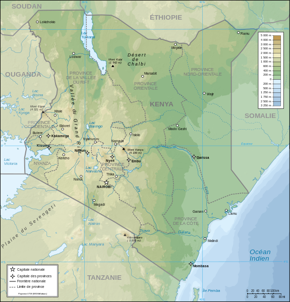
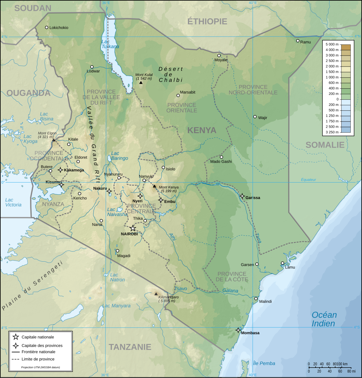
Français : Carte topographique du Kenya. Version française
English: Topographic map in French of Kenya |
| Dáta | |
| Foinse |
Obair féin (Original text: Own Work made with Inkscape From Topographic map : NASA Shuttle Radar Topography Mission (SRTM3 v.2) (public domain) edited with Global Mapper 9 from Visualization Software LLC and vectorized with Inkscape ; UTM projection ; WGS84 datum ; shaded relief (composite image of N-W, W and N lightning positions) ; Rivers, borders, cities : Demis add-on for World Wind ; Other references used : * NASA World Wind ; * File:Kenya-relief-map-towns.jpg ; Notes : The shaded relief is a raster image embedded in the SVG file which increases its size. If you want a lighter map for other purposes, delete the shaded relief image in your file.) |
| Údar | Pinpin |
| Leaganacha eile |
Derivative works of this file: |
| SVG genesis |

| Camera location | | View this and other nearby images on: OpenStreetMap |
|---|
Ceadúnú
Is mise sealbhóir cóipchirt an shaothair seo agus foilsím é faoi na ceadúnais seo a leanas:
| Copyleft: This work of art is free; you can redistribute it and/or modify it according to terms of the Free Art License. You will find a specimen of this license on the Copyleft Attitude site as well as on other sites. |
This file is licensed under the Creative Commons Attribution-Share Alike 4.0 International, 3.0 Unported, 2.5 Generic, 2.0 Generic and 1.0 Generic license.
- Is féidir:
- an saothar seo a roinnt – an saothar seo a chóipeáil, a dháil amach, agus a tharchur
- an saothar seo a athmheascadh – an saothar seo a oiriúnú
- Ach amháin má leantar na coinníollacha seo a leanas:
- sannadh – Ní mor creidiúint a thabhairt leis an saothar, faoi mar a shonraigh an údar nó tabharthóir an ceadúnais (ach ná húsáid modh a thugann le fios go thacaíonn sé/sí tú féin nó an úsáid a bhaineann tú as an saothar).
- comhroinn araon – Má athraíonn tú nó síneann tú amach an saothar seo, ní féidir é a dháileadh ach amhaín faoin gceadúnas céanna nó ceann cosúil leis an gceann seo.
Is féidir leat a roghnú an ceadúnas do rogha
| Annotations | This image is annotated: View the annotations at Commons |
Stair chomhaid
Cliceáil ar dáta/am chun an comhad a radharc mar a bhí sé ag an am sin.
| Dáta/Am | Mionsamhail | Toisí | Úsáideoir | Nóta tráchta | |
|---|---|---|---|---|---|
| faoi láthair | 19:48, 14 Lúnasa 2023 | | 1,181 × 1,231 (3.26 MB) | Sémhur | Correction des latitudes et longitudes |
| 10:00, 30 Aibreán 2008 |  | 1,181 × 1,231 (3.28 MB) | Sémhur | Orthograph : provence => province | |
| 19:48, 7 Aibreán 2008 |  | 1,181 × 1,231 (3.28 MB) | Pinpin | == Description == {{Information |Description={{fr|Carte topographique du Kenya. Version française}} {{en|Topographic map in French of Kenya}} |Source=Own Work made with Inkscape From <br/>Topographic map : [http://www2.jpl.nasa.gov/srtm NASA Shuttle Rada |
Úsáid comhaid
Níl nasc ó aon leathanach eile don íomhá seo.
Global file usage
The following other wikis use this file:
- Úsáid ar avk.wikipedia.org
- Úsáid ar ca.wikipedia.org
- Úsáid ar de.wikipedia.org
- Úsáid ar en.wikipedia.org
- Úsáid ar es.wikipedia.org
- Úsáid ar fr.wikipedia.org
- Úsáid ar nl.wikipedia.org
- Úsáid ar ps.wikipedia.org
- Úsáid ar ru.wikipedia.org
- Úsáid ar uk.wikipedia.org