Íomhá:Map of india position of Agra highlighted.png
Níl aon taifeach is mó ar fáil.
Map_of_india_position_of_Agra_highlighted.png (327 × 351 picteilín, méid comhaid: 338 KB, cineál MIME: image/png)
| Seo comhad as An Cómhaoin Viciméid. Tá an tuairisc as an leathanach tuairisc Cómhaoin a leanas thíos.
|
| Tuairisc |
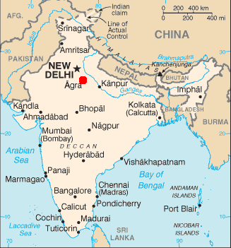
English: Map of India. Position of Agra highlighted. Originated from http://www2.demis.nl/mapserver/mapper.asp. Public Domain. |
| Dáta | |
| Foinse | demis |
| Údar | demis |
This image is in the public domain because it contains materials that originally came from the United States Central Intelligence Agency's World Factbook.
|
 |
Stair chomhaid
Cliceáil ar dáta/am chun an comhad a radharc mar a bhí sé ag an am sin.
| Dáta/Am | Mionsamhail | Toisí | Úsáideoir | Nóta tráchta | |
|---|---|---|---|---|---|
| faoi láthair | 23:00, 15 Eanáir 2005 | | 327 × 351 (338 KB) | Sebastian Wallroth | Map of India. Position of Agra highlighted. Originated from http://www2.demis.nl/mapserver/mapper.asp. Public Domain. {{PD}} |
Úsáid comhaid
Tá nasc chuig an gcomhad seo ar na leathanaigh seo a leanas:
Global file usage
The following other wikis use this file:
- Úsáid ar af.wikipedia.org
- Úsáid ar ar.wikipedia.org
- Úsáid ar arz.wikipedia.org
- Úsáid ar ast.wikipedia.org
- Úsáid ar bg.wikipedia.org
- Úsáid ar ca.wikipedia.org
- Úsáid ar cs.wikipedia.org
- Úsáid ar diq.wikipedia.org
- Úsáid ar el.wikipedia.org
- Úsáid ar eu.wikipedia.org
- Úsáid ar gl.wikipedia.org
- Úsáid ar ha.wikipedia.org
- Úsáid ar hr.wikipedia.org
- Úsáid ar hu.wikipedia.org
- Úsáid ar it.wikipedia.org
- Úsáid ar la.wikipedia.org
- Úsáid ar mzn.wikipedia.org
- Úsáid ar ps.wikipedia.org
- Úsáid ar pt.wikipedia.org
- Úsáid ar ro.wikipedia.org
- Úsáid ar sh.wikipedia.org
- Úsáid ar sv.wikipedia.org
- Úsáid ar tl.wikipedia.org
- Úsáid ar vi.wikipedia.org
- Úsáid ar www.wikidata.org