Íomhá:Oceans and seas boundaries map-fr.svg

Size of this PNG preview of this SVG file: 800 × 447 picteilín. Other resolutions: 320 × 179 picteilín | 640 × 358 picteilín | 1,024 × 572 picteilín | 1,280 × 715 picteilín | 2,560 × 1,430 picteilín | 2,753 × 1,538 picteilín.
Taispeáin leagan ardtaifigh den íomhá (Comhad SVG, ainmniúil 2,753 × 1,538 picteilíni, méid comhaid: 1.42 MB)
| Seo comhad as An Cómhaoin Viciméid. Tá an tuairisc as an leathanach tuairisc Cómhaoin a leanas thíos.
|
Achoimriú
| Tuairisc |
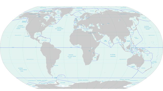
English: World map of oceans and seas : english version
Français : Carte des océans et des mers du monde : version vide |
| Dáta | |
| Foinse | own work made with inkscape from Image:World map pol 2005-fr.svg and from IHO 23-3rd: Limits of Oceans and Seas, Special Publication 23, 3rd Edition 1953, published by the International Hydrographic Organization. |
| Údar | Pinpin |
| Leaganacha eile |
Derivative works of this file: |
This W3C-unspecified vector image was created with Inkscape .
Ceadúnú
Is mise sealbhóir cóipchirt an shaothair seo agus foilsím é faoi na ceadúnais seo a leanas:

|
Tugtar cead an doiciméad seo a chóipeáil, a dháileadh agus/nó a mhodhnú faoi théarmaí an Ceadúnas Doiciméadúcháin Saor ó GNU, Leagan 1.2 nó aon leagan níos déanaí a d’fhoilsigh an Fondúireacht Bogearraí Saor in Aisce; gan aon Rannóga Inmheánacha, gan aon Téacsanna Clúdaigh Tosaigh, agus gan aon Téacsanna Clúdaigh Cúil. Tá cóip den cheadúnas san áireamh sa chuid dar teideal Ceadúnas Doiciméadúcháin Saor ó GNU. |
This file is licensed under the Creative Commons Attribution-Share Alike 3.0 Unported, 2.5 Generic, 2.0 Generic and 1.0 Generic license.
- Is féidir:
- an saothar seo a roinnt – an saothar seo a chóipeáil, a dháil amach, agus a tharchur
- an saothar seo a athmheascadh – an saothar seo a oiriúnú
- Ach amháin má leantar na coinníollacha seo a leanas:
- sannadh – Ní mor creidiúint a thabhairt leis an saothar, faoi mar a shonraigh an údar nó tabharthóir an ceadúnais (ach ná húsáid modh a thugann le fios go thacaíonn sé/sí tú féin nó an úsáid a bhaineann tú as an saothar).
- comhroinn araon – Má athraíonn tú nó síneann tú amach an saothar seo, ní féidir é a dháileadh ach amhaín faoin gceadúnas céanna nó ceann cosúil leis an gceann seo.
Is féidir leat a roghnú an ceadúnas do rogha
Stair chomhaid
Cliceáil ar dáta/am chun an comhad a radharc mar a bhí sé ag an am sin.
| Dáta/Am | Mionsamhail | Toisí | Úsáideoir | Nóta tráchta | |
|---|---|---|---|---|---|
| faoi láthair | 16:32, 9 Nollaig 2007 | | 2,753 × 1,538 (1.42 MB) | Pinpin | == Description == {{Information |Description={{en|World map of oceans and seas : french version}} {{fr|Carte des océans et des mers du monde : version vide}} |Source=own work made with inkscape from Image:World map pol 2005-fr.svg and from IHO 23-3r |
Úsáid comhaid
Níl nasc ó aon leathanach eile don íomhá seo.
Global file usage
The following other wikis use this file:
- Úsáid ar fi.wikipedia.org
- Úsáid ar fr.wikipedia.org
- Úsáid ar ja.wikipedia.org