Íomhá:Water Level Route on US map.png

Size of this preview: 800 × 542 picteilín. Other resolutions: 320 × 217 picteilín | 640 × 433 picteilín | 1,024 × 693 picteilín | 1,280 × 867 picteilín | 2,560 × 1,733 picteilín | 5,912 × 4,003 picteilín.
Taispeáin leagan ardtaifigh den íomhá (5,912 × 4,003 picteilín, méid comhaid: 1.88 MB, cineál MIME: image/png)
| Seo comhad as An Cómhaoin Viciméid. Tá an tuairisc as an leathanach tuairisc Cómhaoin a leanas thíos.
|
Achoimriú
| Tuairisc |
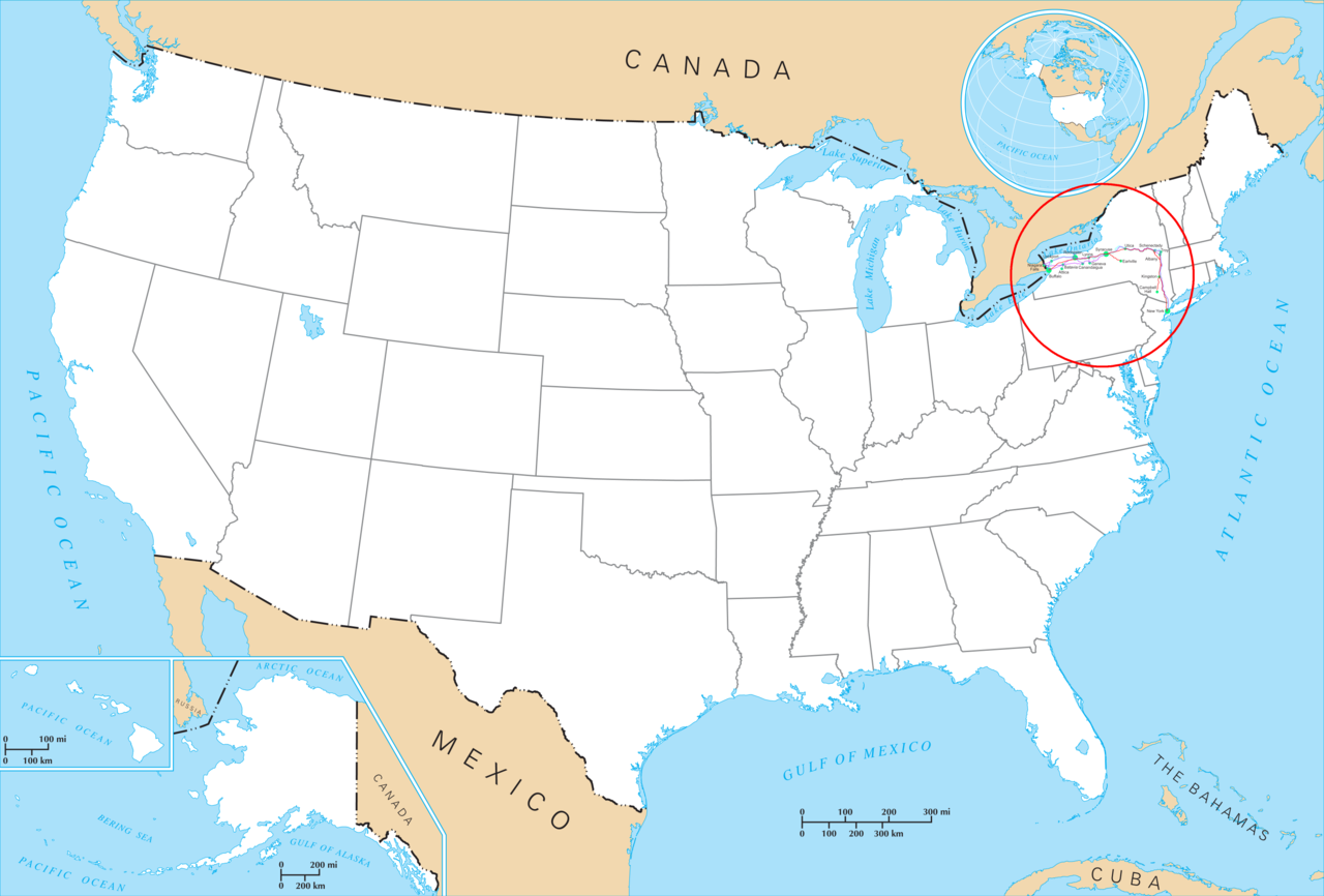
English: Water Level Routes of the New York Central Railroad, West Shore Railroad and Erie Canal on Image:US state outline map.png. See Image:Water Level Route on US map cropped.png for a cropped one. |
| Dáta | |
| Foinse | Obair féin |
| Údar | SPUI |
| Leaganacha eile | Image:Water Level Route on US map cropped.png - uncropped version. |
Ceadúnú
| This work has been released into the public domain by its author, SPUI. This applies worldwide. In some countries this may not be legally possible; if so: |
Stair chomhaid
Cliceáil ar dáta/am chun an comhad a radharc mar a bhí sé ag an am sin.
| Dáta/Am | Mionsamhail | Toisí | Úsáideoir | Nóta tráchta | |
|---|---|---|---|---|---|
| faoi láthair | 19:43, 3 Iúil 2005 | | 5,912 × 4,003 (1.88 MB) | SPUI~commonswiki | {{spuimap}} Water Level Routes of the New York Central Railroad, West Shore Railroad and Erie Canal on Image:US state outline map.png. See Image:Water Level Route on US map cropped.png for a cropped one. category:New York Central Railroad |
Úsáid comhaid
Níl nasc ó aon leathanach eile don íomhá seo.